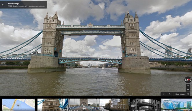
The UK’s River Thames has been added to Google Street View, becoming the first river in Europe to be mapped using Google’s technology. The map follows the Thames for almost 30 miles from Woolwich to Richmond, capturing 360 degree views of the river and the many iconic London landmarks that run along it.
 The London Eye and Waterloo Bridge as seen from the Thames River
 Palace of Westminster
Working with the Port of London Authority, Google UK strapped its Trekker Camera to the hydro graphic surveying vessel Yantlet to capture the images. The Trekker camera allows Google to capture images in areas that its Street View van and Trike can’t access.
Google Street View was first introduced in the US in 2007 and has since expanded to over 3000 cities in 53 countries, going beyond streets to let you inside restaurants and shops, ski resorts and slopes, and now, even taking you along waterways. The River Thames joins Antarctica and the Grand Canyon in Google’s quest to visually capture all corners of the world.